 Initially my intention had been to bike across the Tibetan Plateau, hence why my trip started in that part of the world. It turned out to be too expensive to organise on the ground from Kathmandu and in hindsight it would have been better to approach Tibet from the Beijing side if I wanted to ride the plateau self-supported. The result was that I saw Tibet by Jeep and it was an unforgettable experience. However, I was disappointed having to sit cooped up in a Jeep when I wanted to bike some of the highest road passes in the world.
Indeed, in adventure-cycling terms it is unclear what the highest road pass in the world is. Some passes have stated altitudes higher than their reality. Some people debate the basis of the word 'pass'; does it have to be on a sealed road or can it be a track? Must there be traffic to justify it as an actual pass over a mountain? In lieu of asphalt and traffic surely the fact that a public bus uses the track satisfies the criteria of a high pass etc. Most people consider the Khardung La pass in the Indian Himalaya to be the highest road pass in the world. This road goes to a stated altitude of 5682ms but GPS systems only measure it at 5359ms. Thus, there is a lot of debate about the whole issue of biking high.
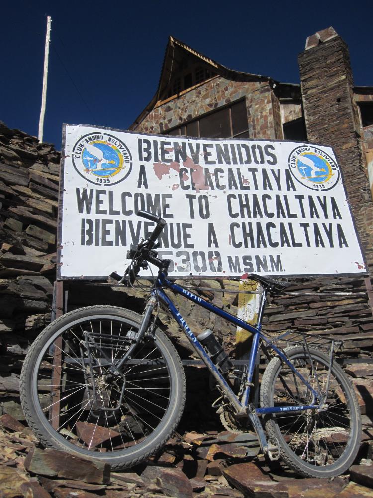
Travelling across the only other high plateau in the world besides Tibet and through the second highest mountain-range in the world would provide me with a second chance to bike high. Just outside La Paz lies Mount Chacaltaya, the 'highest' ski-station in the world at 5300ms. It is a glacial resort but allegedly global warming has melted its ice making the place redundant even in the depths of Bolivia's winter (which is rather mild). Of course nature is rarely so precise making the GPS measurement of 5261ms a more accurate guide. Thus, the ascent of Chacaltaya was the last item on my agenda before I would embrace the road to Cusco.
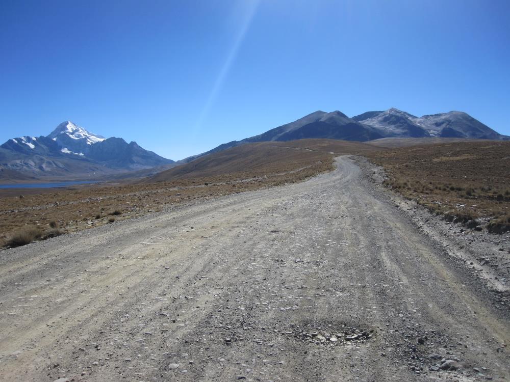
My friend Cristian reckoned an ascent would take the average cyclist 8 hours starting from La Paz at 3600ms. He based this on the experience of other riders but thought I should manage it in six. I thought somewhere between four and five would be more likely considering it was not all that far away. Thus, I left a little later than I should have so that I would be able to avail of the pancake breakfast in the hostel. To satisfy the requirement of a pass I would climb to the ski-station, then hike for twenty minutes around the back of the peak to take a different road down to La Paz. However, the road was far from sealed. Once I navigated the very steep lower sections out of La Paz I would have an easier time of things. However, the first 400ms vertical only took me to the Alti-plano and from there I would have to take a hellish dirt-road to Chacaltaya. I had seen a lot of the terrain before because it is the same road I took to climb to the summit of Huyana Potosi by foot; Chacaltaya is the peak beside it. Thus, the day was more about grinding it out than taking in the views. The road made progress very slow going but I was still pedalling away with only the occasional photo-stop. Once I got to 4900ms the thin air was having an effect. If I pushed too hard then there wasn't enough oxygen to power my heavy bike skywards, so I just had to take it slowly eventually settling for little breaks every three hair-pins.
I eventually crested to the applause of a handful of tourists and a care-taker who was more than quick to show me hospitality in the form of both the most expensive and weakest mate de coca I have ever seen. For 20Bs I could have bought four big bags of coca leaves and here I was getting 4 leaves in a cup of hot water for the same price because neither of us had change ... or rather I didn't have change and he pretended not to. It had taken me four and half hours to climb without making a race of it and so I was glad that my instincts had been right as I don't like missing out on pancakes.
It was pretty windy up there and the care-taker was anxious to lock-up as he had pocketed his money for the day courtesy of dim-wit. He wouldn't let me hike around the back of the mountain claiming that there was no road there. True, it's an abandoned road but it still exists. Thus, I headed back the way I came thinking that it doesn't matter whether a road is sealed or not, nor whether it is a pass or not, it only matters how high you can actually cart the bike under your own steam. Thus, I was pretty satisfied to be able to say that I managed to cycle my bike as high as 5261ms (mas o menos). Unfortunately for me the work was in getting back down the mountain. The road was one of the worst I have biked on making the descent particularly bone-crunching as my bike has no suspension to handle such surfaces.
The ascent of Chacaltaya is another notch in my belt. Now it's time to put all my little altitude games behind me. Peru is calling.
I hope northern hemisphere summer is treating you all kindly
Marco
 Mount Chacaltaya 5261ms to the right, Huyana Potosi 6088ms to the left
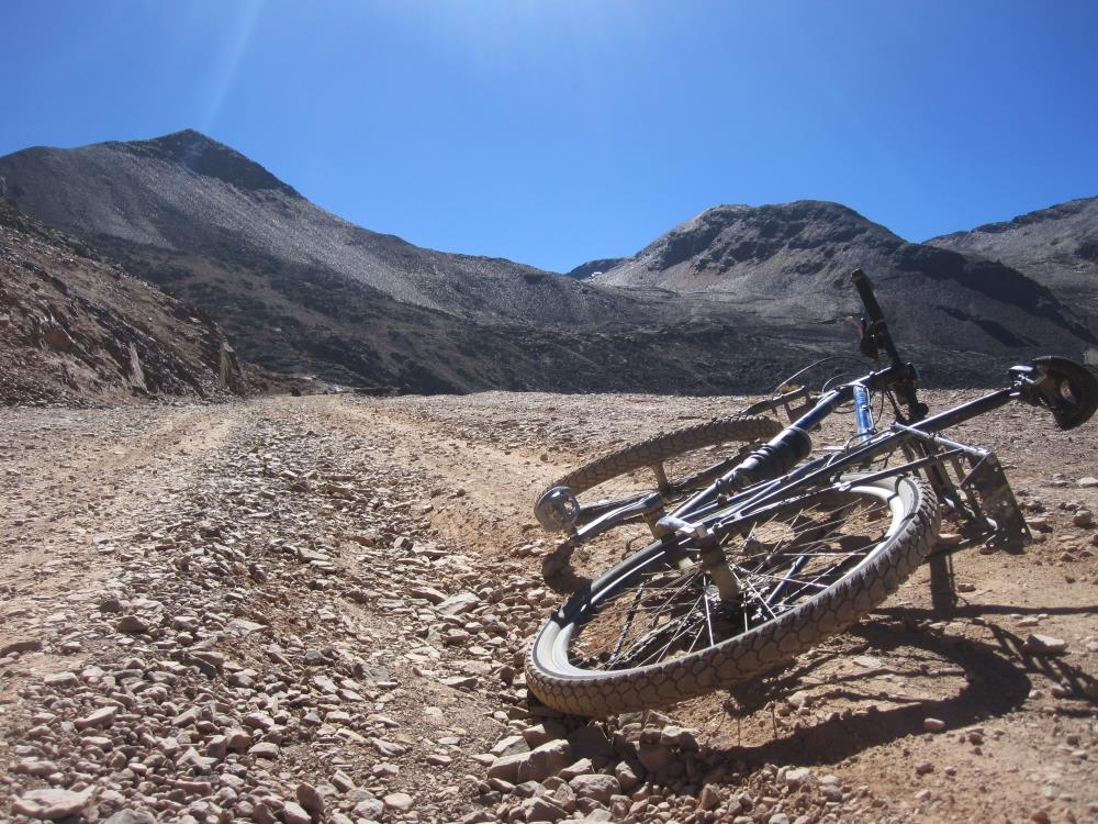 the ski-station is the white box to the right of the dip
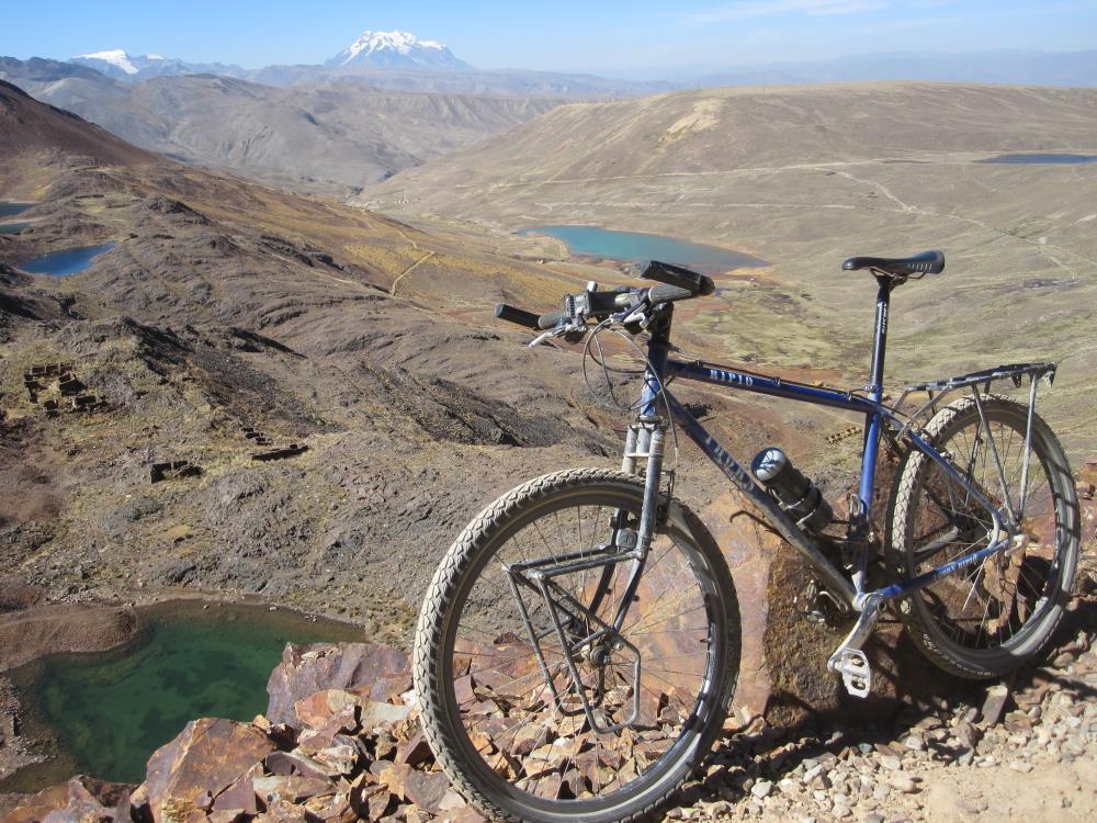 Mount Illimani in the distance 6438ms
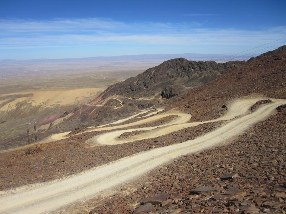 the road snakes down to La Paz in the distance
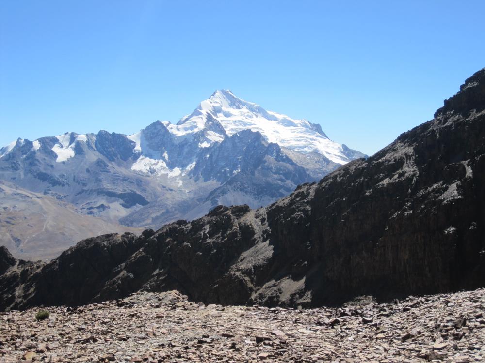 Huyana Potosi
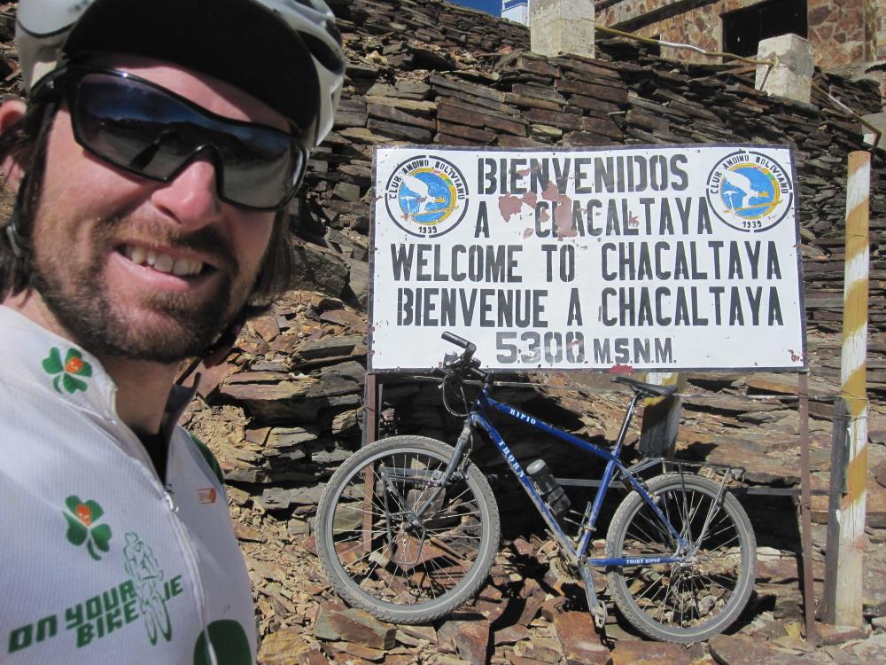 made it!